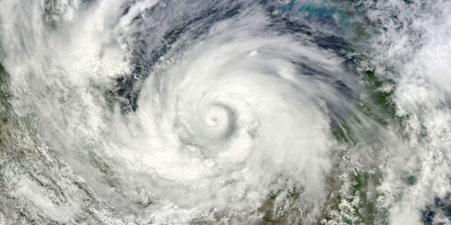
Typhoons arrive with unexpectedly gentle names. Instead of the personal names used for Atlantic hurricanes, storms in this part of the world are named from rotating lists supplied by the countries and regions around the basin, and those lists are full of local animals, plants and cultural objects. A storm may be called after a bird, a flower or a dish.
The thing being named is one of the largest heat engines on the planet.
How a typhoon is built
A typhoon needs three ingredients, and warm water is the first. When the sea surface is hot enough, huge volumes of water evaporate and rise, and the air pressure at the centre of that rising column falls. Surrounding air rushes in to fill the gap.
The second ingredient is a small pre-existing disturbance — a weak tropical swirl for the process to organise itself around. The third is the earth's rotation, which deflects the inrushing air so that instead of flowing straight to the centre it curves, and the whole system begins to spin.
After that it feeds itself. Rising moist air condenses, releasing heat, which drives more air upward, which draws in more warm moist air from below. As long as the ocean underneath stays warm and the winds at different altitudes stay reasonably uniform, the storm keeps growing.
Incidentally, hurricanes, cyclones and typhoons are the same phenomenon. They are given different names depending on which ocean they form over.
Why so many reach China
The short answer is geography.
The northwest Pacific and the South China Sea together form the most productive tropical cyclone region on earth — and the only one where storms can form in any month of the year. China sits directly downwind of it, which is why it records more typhoon landfalls than any other country. This is a permanent feature of where the country is, not a recent development.
What does change is the calendar. The season runs roughly from spring into late autumn, but activity concentrates sharply in late summer and early autumn. Sea surface temperatures in the northwest Pacific reach their annual maximum around September and October, and because land cools faster than water, the temperature gap between sea and land widens at the same time. Both favour storm formation. A cluster of storms in August is not the weather behaving strangely; it is the peak of the season doing exactly what it does.
Forecasters also watch a longer trend: warmer oceans hold more energy, and that is an active area of research rather than a settled story.
Two different families
Not all typhoons behave alike, and the difference matters for how much warning you get.
Storms born far out in the northwest Pacific have room to develop. They tend to be large, well organised and comparatively predictable, and they take days to travel, which means several days of advance notice.
Storms that form in the South China Sea are a different animal. They are usually smaller and shorter-lived, often lasting only three or four days from formation to landfall. Many never develop a clear eye or tidy spiral bands. Their paths can stall or turn sharply, which makes them significantly harder to forecast.
Reading a forecast properly
Two common misreadings are worth correcting.
First, the shaded cone on a track map is not the affected area. It shows the range within which the storm's centre is likely to pass. The wind and rain reach well beyond it, and a place hundreds of kilometres from the centre can still get a soaking.
Second, a lower-intensity storm is not automatically a mild one. Rainfall is often heavily lopsided, concentrated on one flank rather than spread evenly, and a relatively weak system meeting the right conditions can produce far more rain than its category suggests. Judge by the forecast, not the number.
The practical part
Preparation is unglamorous and takes about half an hour.
Beforehand, bring in anything on the balcony that could shift — pots, drying racks, folding stools. Check window and door seals, and lay a rolled towel along any sill that leaks. Move the car away from large trees and out of low-lying car parks, early rather than late. Charge phones, laptops and power banks. Keep a few days of food that needs no cooking, plus drinking water, and refill any prescription that is running low. Keep a torch with working batteries and a few phone numbers written on paper.
While it passes, stay indoors and away from exposed glass. A sudden calm does not mean it is finished, so wait for warnings to be formally lowered before going out — and note that a lowered warning is not quite the same as an all-clear, since conditions can stay unsettled for a while afterwards.
Then check the forecast again. The storms come every year, and knowing how they work is most of what makes them manageable.